Imperial Supercell
Tags: Stormchasing
Posted on Thursday 27 May 2021, 18:35 (last modified: 27 May 2021, 18:36)
Radar and GPS animation
In this blog post I describe in detail my storm chase experience of the Imperial Supercell, featuring radar, gps tracks and photos taken. You can click here to watch a video of the radar animation combined with our gps track, or watch it at the of this post.
Waiting Game
We are 4 days into our storm chasing trip in Tornado Alley, which so far has been eventful but did not result in particularly great photos. Today is another day with a high potential for supercells, though in better terrain: eastern Colorado. We start around noon and keep track of so called 'upslope' storms; the Rocky Mountains in central Colorado force the weak easterly flow upward, causing storm initiation. Storms, should they develop a deep enough structure, get picked up by the strong westerly flow aloft. The storms that roll off the Rockies will enter, we forecast, atmospheric conditions conducive for strong supercells and potential tornadoes.
The first potent storms rolls off the Rockies at a little after mid day and we get in position to the north east. We are still quite far away, it would take a few hours to get to us, but we don't want to get too much out of position for other future storms. Basically, we are waiting and maintaining a strategic position. This is challenging, because this first supercell is beautiful on radar, with a solid mesocyclone.
Fast forward a few hours and we are standing near the storm's base. The system is a bit unstable, featuring multiple areas of low level rotation visible on radar. The storm's low level rotation keeps reorganizing and new precipitation forms just south of us while a more northward core intensifies. We decide not to track this storm along a southwest-northeast oriented road, we would be too close to the hail core and also be out of position for later. Instead, we go straight east and north.
Just as we are making this decision, there is convective initiation south of us, and this is where the fun begins.
Birth of 'Imperial'
There are now two clear storms to chase, a north and south one. The northern storm is hours old by now and massively HP (precipitation dominant), while the southern one isn't quite surface based nor producing serious precipitation. It does have a clear mesocyclone, however. South of this storm is completely clear, so great viewing conditions. But we are still north of it, driving towards the north, trying to catch the HP. It has an absolutely massive structure, but it appears we are arrived just too late with our cameras. Things are happening quickly now, all of a sudden the southern supercell is intensifying on radar and we are right in its path.
It is about 17:25 MDT (local time) now. The first figure shows the current radar data on this moment, with our gps track as the solid black line. Our current position is indicated with the red dot, right between the HP moving off towards the north east and the rapidly intensifying supercell to our south west. Looking towards the south west, there is a wall cloud forming underneath the rain free base. You can see this in figure 2.
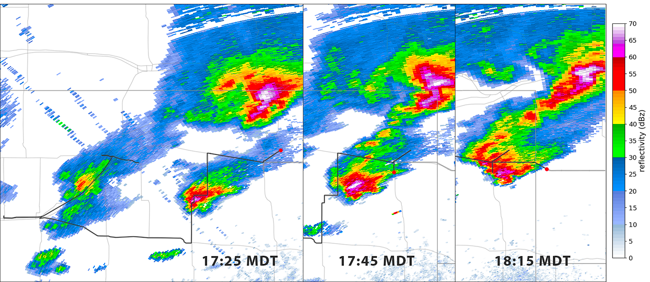
Fig 1. Radar panel showing radar reflectivity for various timestamps. The left most image also shows an extra part of the gps track.
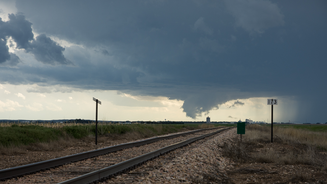
Fig 2. Capture time: 17:23 MDT
We decide to move south a bit. About twenty minutes later, we have a fantastic view of the isolated intensifying supercell. The corresponding radar image is the middle frame in Figure 1, at 17:45 MDT. The next two images, visible in Figure 3 and 4, show the development of a wall cloud spanning nearly the whole base. There are just 4 minutes apart!
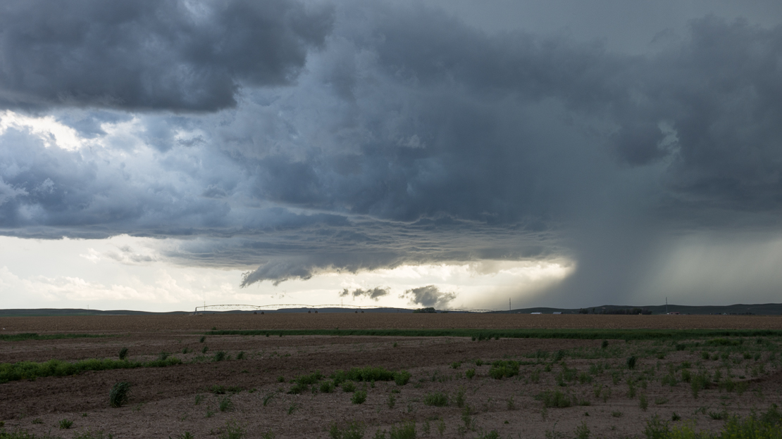
Fig 3. Capture time: 17:38 MDT
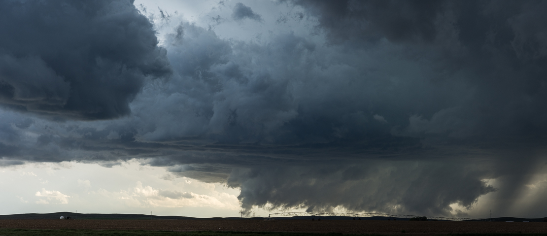
Fig 4. Capture time: 17:42 MDT
Is it a tornado?
The storm is moving slow enough for us to enjoy the view and not having to keep rushing ahead of its track. We do move a bit further east as the storm is getting close now and stop again at the position in the right-most radar image in Figure 1. The view at this location is what we hoped for when making the forecast this morning. Is it a tornado? It's hard to see, partly hidden behind the hill top and obstructed by rain, but on radar the rotation was certainly there.
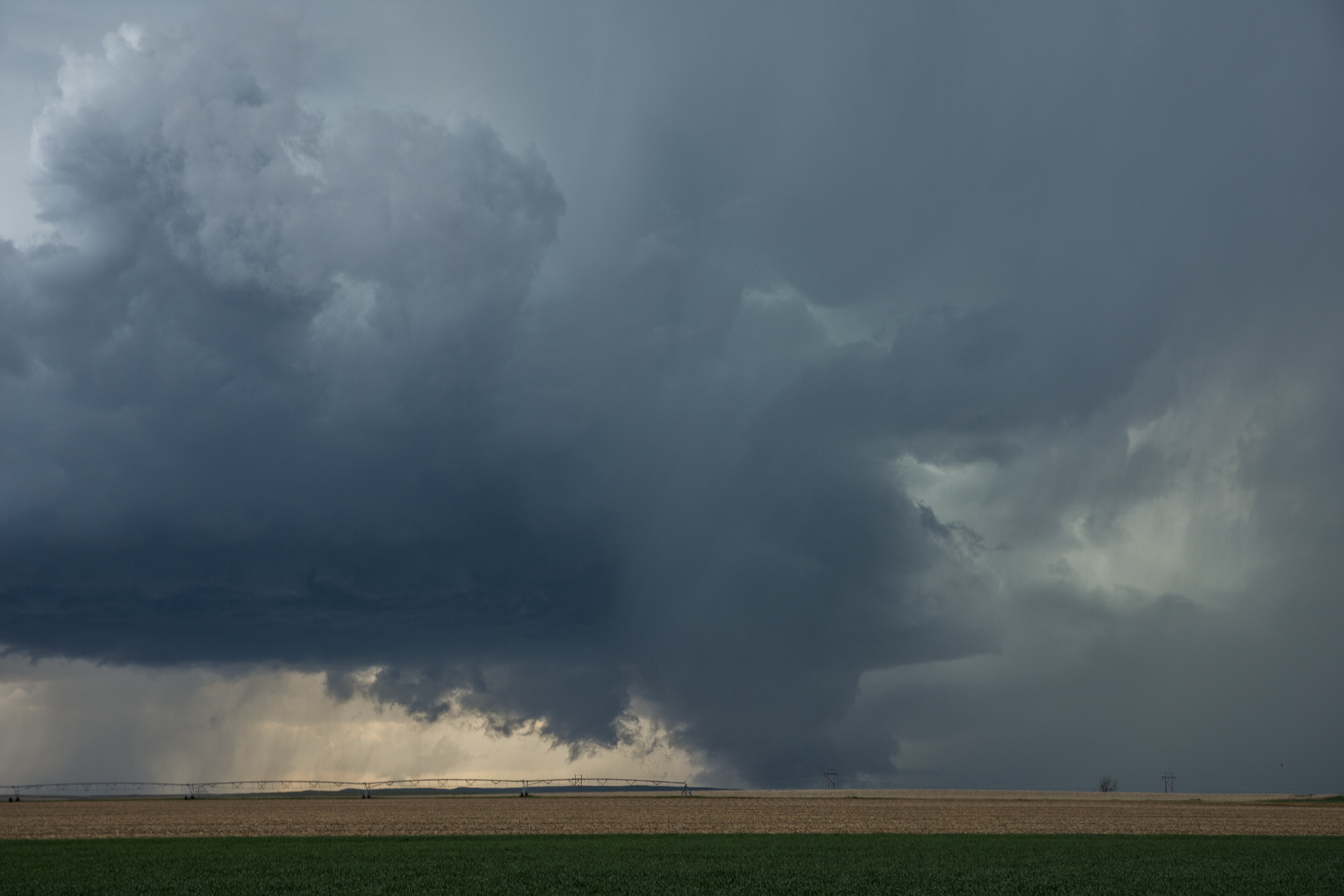
Fig 5. A photo of what might be an obscured tornado, taken at 18:13 MDT
We're feeling confident enough to let the storm get closer and you can see in figure 6 how our gps position is right at the edge of the supercell at 18:30 MDT. We're too focused on what's happening near the ground, feeling any of the low hanging rotating clouds could turn into a tornado at any moment now. We should probably have paid more attention to the hail core. Although rotation is hard to show in static images, there are three tornado candidates visible in the 7th figure. In the center, on the right a smooth funnel and one in the behind on the left...
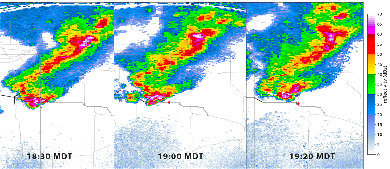
Fig 6. Radar panel showing radar reflectivity for various timestamps
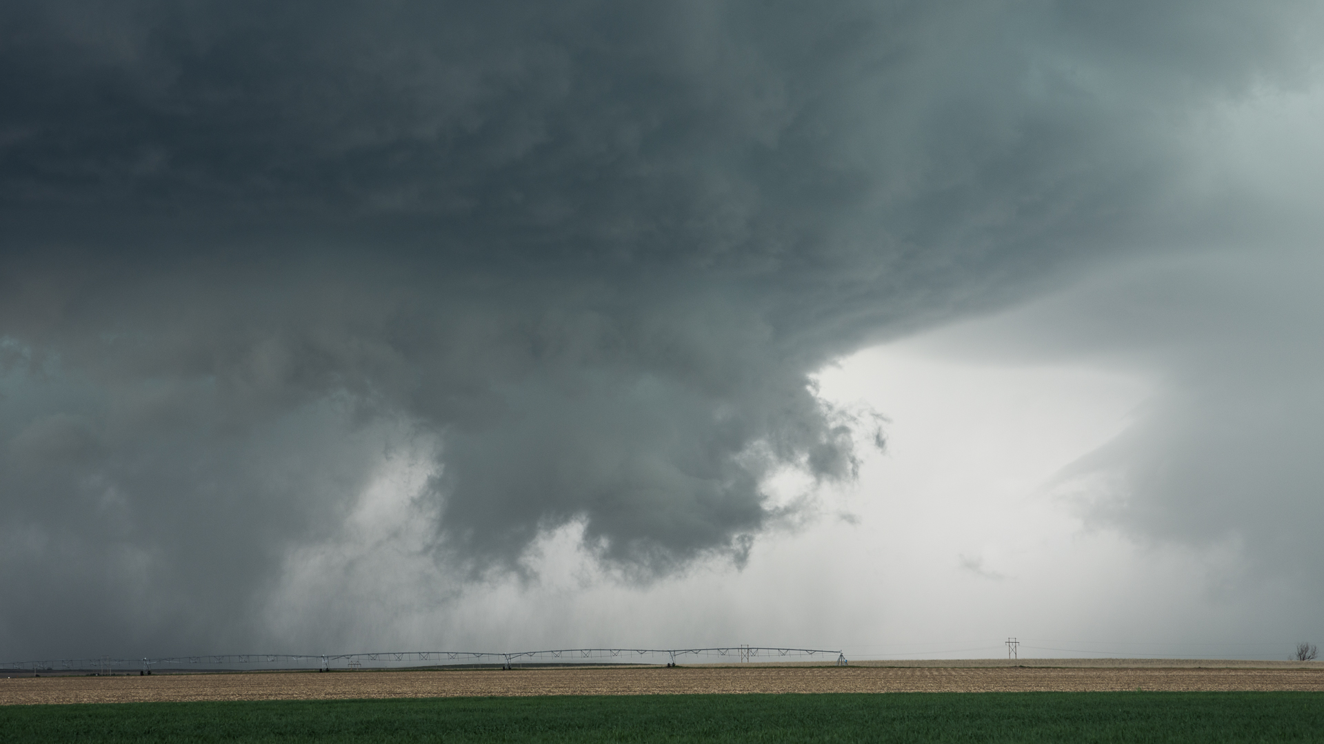
Fig 7. Three points of rotation, close up shot taken at 18:35 MDT
Peak Structure
What happens next is wild. Large hail starts falling around us, so we rush to the car and race towards the east to escape the hail. In that same time, the supercell is developed a 'mothership' structure. I found this hard to capture with photo, as it filled completely our field of view.
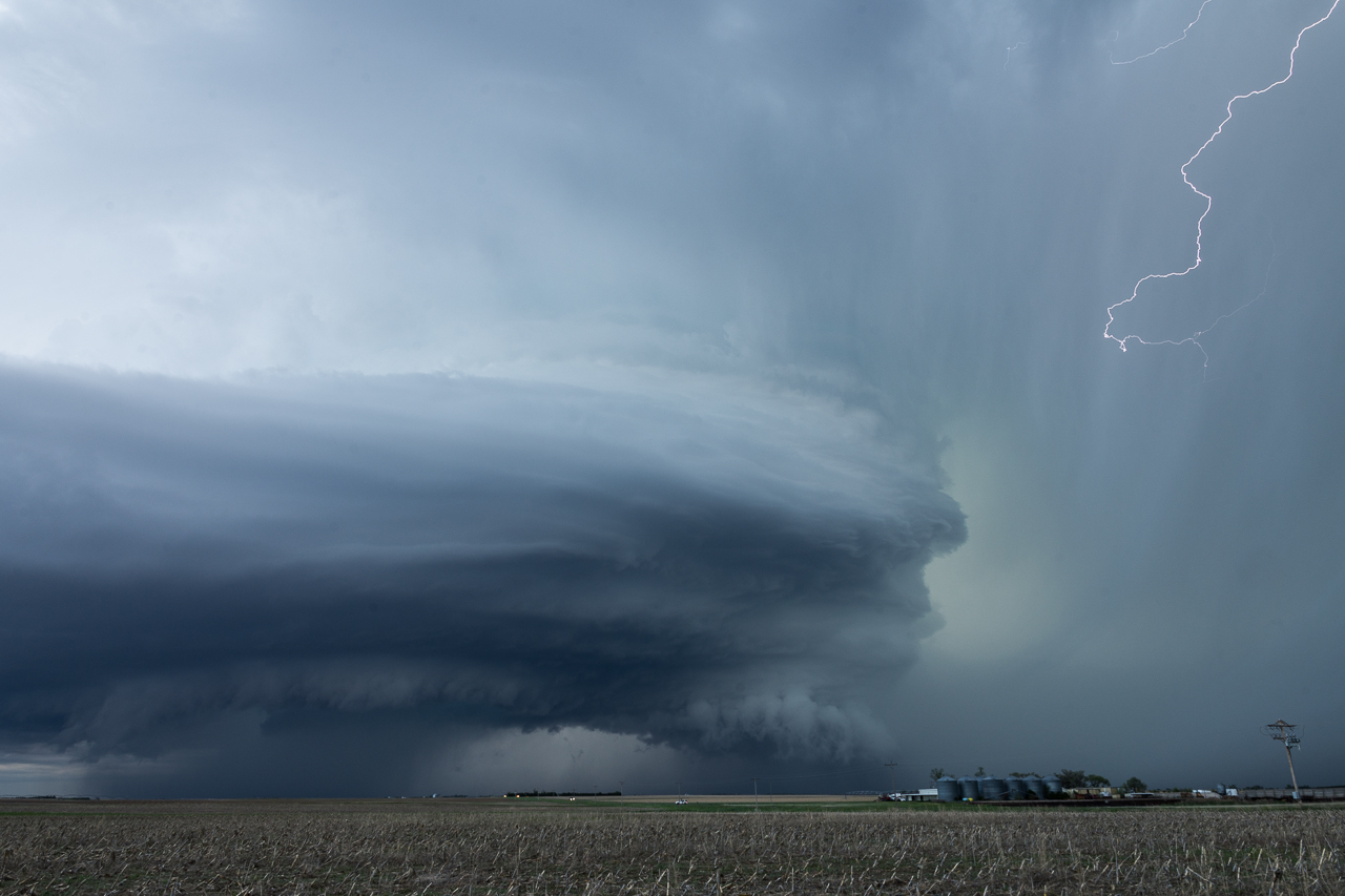
Fig 7. Imperial HP structure taken at 19:03 MDT
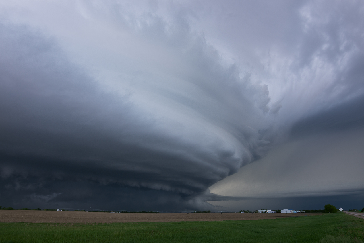
Fig 8. Peak Imperial HP mothership structure, 19:22 MDT
I have a few more photos of the supercell posted here. If you would like to see our GPS track animated with radar imagery, for both reflectivity and velocity, watch the following video: